
Scottish Borders Region
The Cheviot - G/SB-001
Next SB Summit
Previous SB Summit
| Grid Reference | NT 90905 20525 |
| Latitude/Longitude | 55°28'42.4"N, 2°8'43.6"W |
| Maidenhead Square | IO85WL |
| Height | Height: 815 M / 2674 ft |
| Points | 8 |
| Bonus | 3 points between 1/12 and 15/3 |
The Cheviot is the highest summit in the Scottish Borders Region, but only the 12th highest Marilyn in the
 |
|
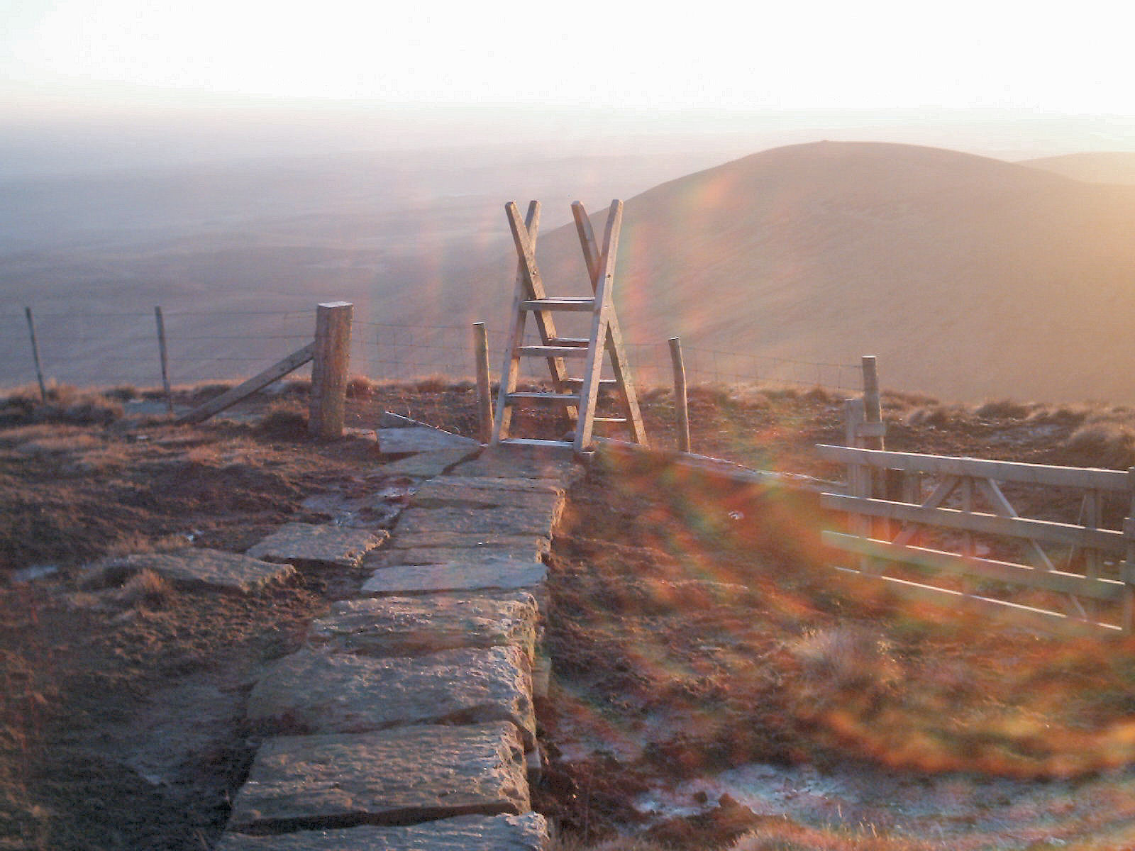
Across the top of The Cheviot, the path to the summit and the Pennine Way are paved with ¼ ton flags. |
Activators & Chasers should both be very happy that this summit lies
just a mile inside England from the Scottish Border as it is worth 8 points
whereas, if the ancient border had remained and this summit was on the Scottish
side it would be worth only 4 points as a consequence of the height banding
differences between the English and Scottish Associations.
Simply because of it's height, activation via VHF should not present any
problems as there is good line of site in almost all directions and a good
signal into Northumberland and Tyneside. This summit has a clear path to
all the other summits in the SB group though even in good visibility, it
will not be easy to identify those other summits by eye. Summit to summit
should be possible with others of the SB group, many of the SS group, TW,
NP & LD and possibly much further afield depending on conditions although
most likely are NP and LD since those summits are more regularly activated.
|
|
|
 |
|
|
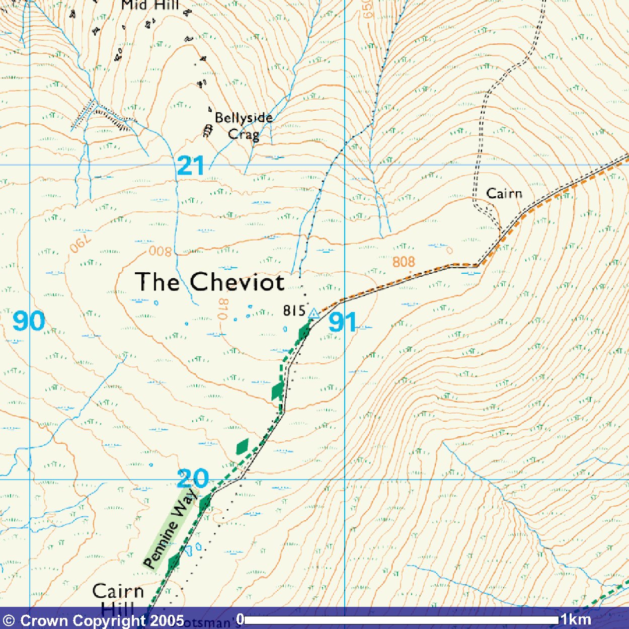
© Crown
Copyright 2005 Image produced from Ordnance Survey's Get-a-map service. Image reproduced with kind permission of Ordnance Survey and Ordnance Survey of Northern Ireland. |
|
Note that "open country" is indicated by the light yellow shading
Next SB Summit
Previous SB Summit
Getting There,
From the south take A1 north and branch left onto the A697 north of Morpeth just before the dual carriageway converges to single carriageway. Follow the A697 through Longhorsley, Longframlington and Powburn to Wooler. As you enter Wooler and cross the river, take the left fork marked town centre up the hill. At the top of the hill, as you face the Anchor Inn, you take a very sharp left turn into Cheviot Street and follow the minor road to Middleton Hall. On that minor road you'll come to a fork where you take the right branch. At Middleton Hall, turn sharp right, up a steep hill, to follow the minor road along the Harthope Valley to find car parking beyond Langlee Farm. As you drop down Skirl Naked into the valley you may come across a significant number of cars parked on a grassy area to the right of the road, just before Carey Burn Bridge - do not stop here but continue for a further 3 miles approx. The parking areas are just grassy areas on either side of the road at NT 95340 22530 near Hawsen Burn and there is a sign at the side of the road at this point advising that there is no parking beyond this point further up the valley.
If you wish to avail yourself of public toilets before proceeding up the valley stop off in Wooler as the public toilets at the picnic area near Middleton Hall are now out of action as a consequence of government under-funding of the national parks.
From the north west take the A697 south off the A68 at Carfraemill and after passing through Coldstream and crossing the border into England, proceed south to Wooler. It is probably easier to continue on the A697 to the other end of the village, rather than take any of the other signposted roads into the village. At the end of the village the A697 turns quite sharply left to cross the river while a sharp right turn off the A697 which you should take, leads up the hill to the village. At the top of the hill, follow the directions above as for from the south.
From the north east turn off the A1 into
Belford and from there take the B6349 for Wooler. At the T junction
end of the B6349 turn right (north) onto the B6348 and follow that into
Wooler. Reaching the A697 turn left (south) toward the end of the village
and where the A697 turns quite sharply left to cross the river, turn right
instead and proceed as for from the south.
Suggested Approach, approx
walk in 3.25 miles 5.25km
As you look up the valley, from the parking area the summit on your left
is Hedgehope and the summit almost straight ahead but to the right is The
Cheviot. The col between these two drops by only 131 metres from Hedgehope
as is indicated by a spot height on the 25k OS maps of 583 metres, so as a consequence,
Hedgehope at 714 metres is not a Marilyn.
From the parking area walk further up the valley for about
 |
|
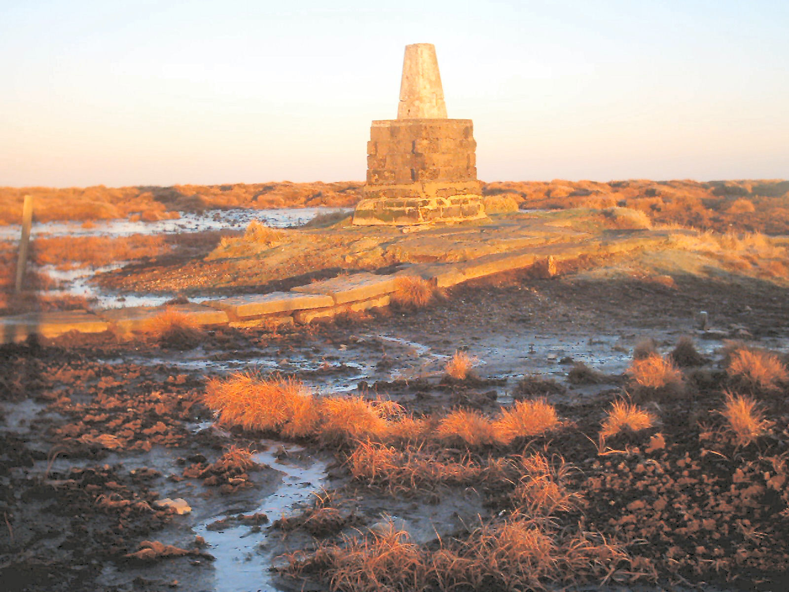
It is reported that when the trig point was first installed the ground level of the peat was almost up to the base of the trig, so what we see today represents over 1 metre of erosion across the top of The Cheviot probably through wind erosion. |
Much of the grasses that you can see either side of the path are quite recent resulting from extensive replanting by the National Park. Before the large flagstones were helicoptered in, much of the summit area was churned up into a peat bog by the huge amount of pedestrian traffic. The summit itself is marked by the presence of a trig point around which there is a fairly small area of firm-ish land surrounded by peat bog.
Although the summit area is very rounded and the potential activation
area within 25 metres height of the summit is large, it is not easy to find
a good place from which to operate away from the summit because of the general
bogginess of the area.
GPS Route Download,
Download Garmin Mapsource GDB
format »
Download Memory Map format »
Post Summit Retreat,
For refreshments after activation, there is quite a choice available
in the village of Wooler, and if food is also desired then depending
on the time of day The Red Lion Hotel, The Black Bull Hotel, The Angel
Inn, The Anchor Inn or The Tankerville
Arms Hotel are known to have food available. If you followed the
directions above, then as you drove up into the village, you came up
into Peth Head and on your right before you turned into Cheviot street,
was the Rendevous cafe. After refurbishment in 2007, this reopened
as a specialist in locally sourced and organic food, it was well worth a visit,
but unfortunately it now appears to have been hit by the recession and
as last seen in September 2009 was closed and in the process of re-furbishment.
In the Market Place there is another cafe from which food should be
available most of the day. Also
in the Market Place, there is a fish & chip shop that was taken over at the
end of 2006 and renamed Foulis Fish & Chips and this has better opening hours
than the previous owners. It seems to be generally open evenings after
4:00pm and has lunchtime opening except on Sundays. Further down the
main street, the Breeze gift shop also offers a cafe facility and on the
opposite side of the the road is Mojo's coffee shop & restaurant. If you
would like further tourist information then at then north west end of
the main street forking slight left is Padgepool Place, where there is
free parking and tourist information in the Cheviot Centre
Last updated 17th Oct 2009. Please advise of any errors, even schpelling!!