
Summits on the Air
Scottish Borders Region - G/SB
| Site Notes: |
| On every page in this site the SOTA logo at
the top of the page provides a link to the official SOTA website. |
| All pictures in the text have a
link to a full size picture. |
 |
|
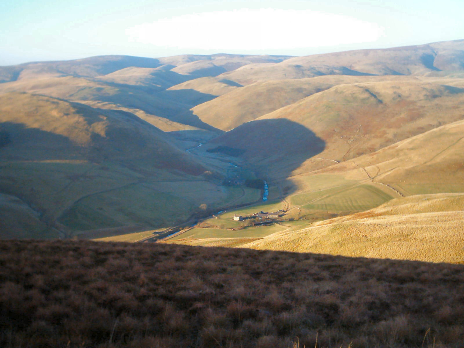
A view across the SB Hills from Shillhope Law |
Visitors to this region are often surprised by the much lower amount
of radio activity than further south, so do not simply expect to put out
a few CQ calls on 2m VHF or 70cm UHF and experience a flood of replies on
every summit in this region. The region has indeed been relatively quiet
in terms of SOTA activity prior to 2006 but into 2006 the level of
activity has increased significantly.
 |
|
|
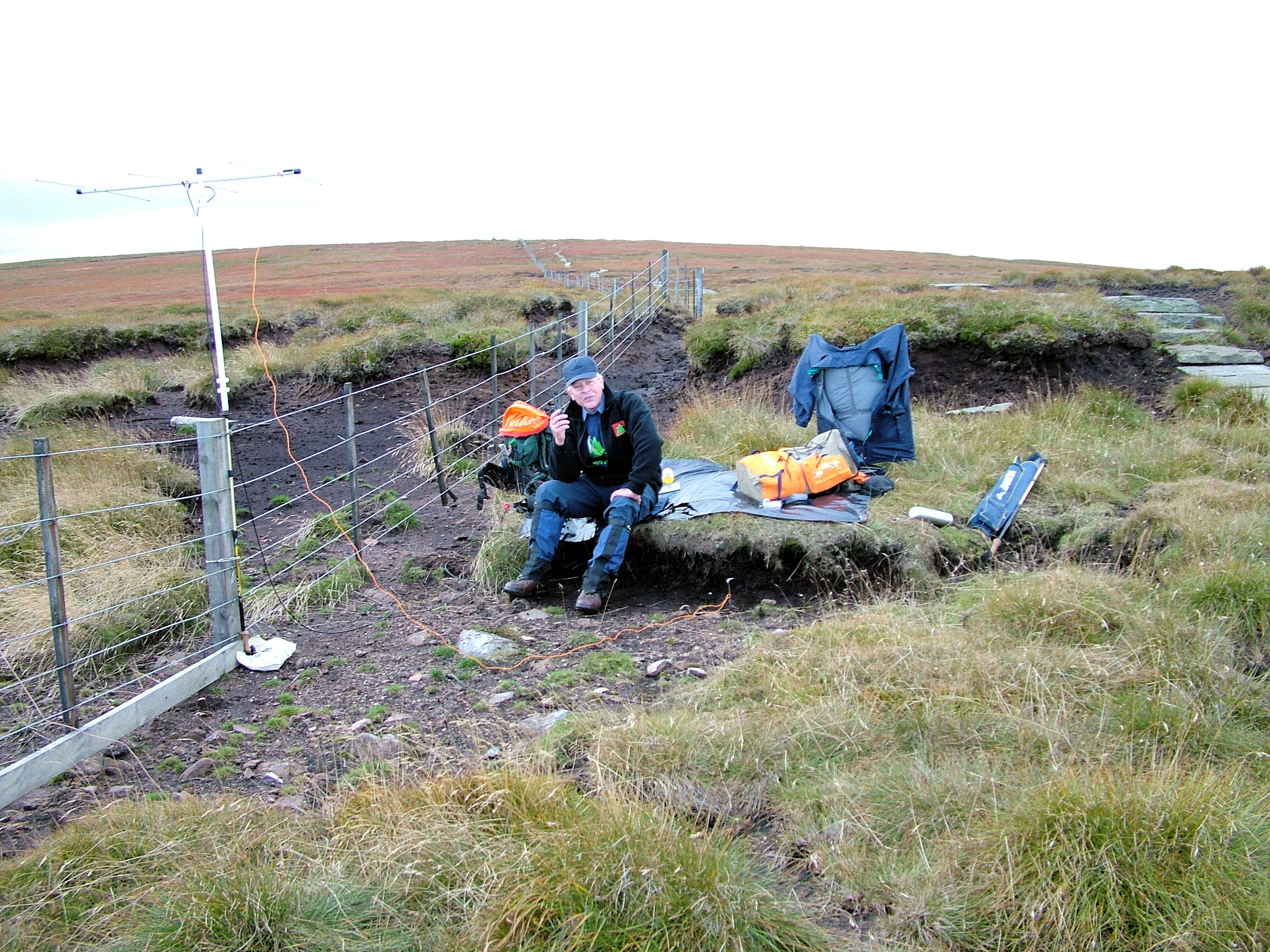
Operation on The Cheviot. The fence provides mounting for the antennae avoiding the need to use guys. Bungy cords work well for attaching to fence posts |
We strongly recommend that prior to attempting any activation in the SB area, you post an alert of your intention on the SOTAwatch Alerts site. There are a few activators and chasers in the North East who monitor the SOTAwatch Alerts site who will listen out for your call, but will also advise other amateurs in the area of your activation attempt and that will dramatically increase your chance of success. Over time it is the intention to record some specific experiences of SOTA activators in each of the pages on this site devoted to each of the individual summits.
Of the 8 summits in the Scottish Borders Region, three lie within the Northumberland National Park namely, The Cheviot,
|
|
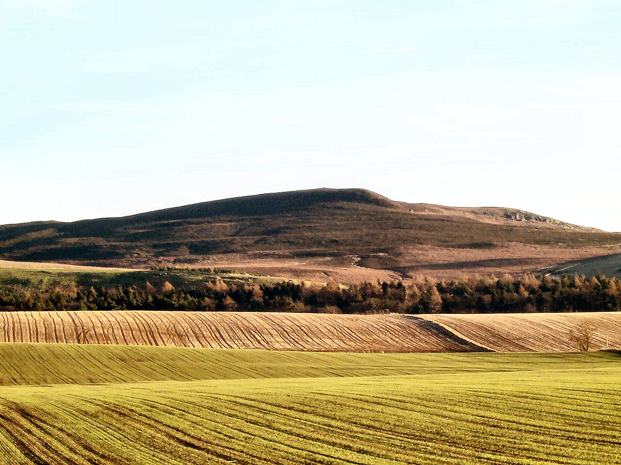
Long Crag from the south across the fields. |
Some of the photographs and route information contained in this site
were kindly provided by John, G4YSS.
There is no SB-002 nor SB-003 in this group. These reference numbers were assigned to Hedgehope (SB-002) and Cushat Law (SB-003) before it was clarified that cols between each of these and The Cheviot do not drop the minimum 150 metres required for Marilyn qualification.
For details of each summit click on either its name or its reference number to go to the summit page.
| SOTA Ref. | Name. | Height (m) |
Points |
|
| SB-001 | The Cheviot | 815 |
8 |
|
| SB-004 | Peel Fell | 602 |
4 |
|
| SB-005 | Sighty Crag | 518 | 2 | |
| SB-006 | Shillhope Law | 501 | 2 | |
| SB-007 | Tosson Hill | 440 | 1 | |
| SB-008 | Long Crag | 319 | 1 | |
| SB-009 | Ros Hill | 315 | 1 | |
| SB-010 | Housedon Hill | 267 | 1 |
CRoW
The Countryside Rights of Way legislation was implemented in this region from 28th May 2005 with the conclusive maps having been made available from 7th March 2005. While it is possible to approach all SB summits across CRoW "Open Country", it may be that these areas are closed at the discretion of the landowner or tenant, for up to 28 days in any calendar year. The person entitled to apply for closures is either the owner of the land if there is no farm tenancy or the farm tenant if the land is subject to a farm tenancy agreement. However the discretionary days are subject to certain rules and cannot be:
- on any Bank Holiday, Christmas Day or Good Friday,
- on more than 4 Saturdays or Sundays in any one year,
- on any Saturday between 1st June and 11th August,
- on any Sunday between 1st June and 31st September.
Details of closures and any other restrictions for
each of the SB summit areas are available from the Countryside Access
website although using this website is to say the least rather cludgy.
It is badly designed and can be extremely frustrating to use especially
as in order to specify a range of dates, after entering your date range,
you must specifically reset the "Specific date" field from its default
of "Tomorrow" to "---Select One----" or else you get an error message.
Additionally you cannot paste a 2 letter/10 digit grid reference
straight out of any of the computer mapping systems e.g. Garmin
Mapsource as these contain spacing between the letters, easting and
northing, whereas this site will only accept a 2 letter/10 digit grid
reference with no spaces. To use the Countryside Access website for the
SB region summit start at
http://www.countrysideaccess.gov.uk/things_to_do/open_access/open_access_maps
and select region 5. Use the OS grid reference shown on the pages for
each summit in this site after removing the blanks between the letters,
easting and northing. When you get the results, scroll down to see the
restriction or closure details. Feedback has been submitted on these
issues to the Countryside Access website so hopefully improvements will
result or maybe pigs might fly.
The Maps
For each summit, a 2km square map obtained from the Ordnance Survey's Get-A-Map service is reproduced in accordance with the terms displayed on the Get-A-Map site and with the kind permission of Ordnance Survey and Ordnance Survey of Northern Ireland. The maps on the Ordnance Survey's Get-A-Map site have been updated since end May 2005, to indicate CRoW "open country" with a light yellow shading.
Information Centres
The centres listed below are not all open throughout the year and it
is advisable to check opening times if planning to visit any of them.
To Table of Summits
| Northumberland National Park Centre, Church House, Church Street, Rothbury, NE65 7UP TEL: +44 (0)1669 620887 FAX: +44 (0)1669 620887 EMAIL: tic.rothbury@nnpa.org.uk |
Northumberland National Park Centre, Ingram, Powburn, Alnwick, NE46 4LT TEL: +44 (0)1665 578248 FAX: +44 (0) EMAIL: ingram@coquetdale.net |
| Northumberland National Park Centre, Once Brewed, Military Road, Barden Mill, NE47 7AN TEL: +44 (0)1434 344396 FAX: +44 (0)1434 344487 EMAIL: tic.oncebrewed@nnpa.org.uk |
To Table of Summits
| Alnwick Tourist
Information Centre 2 The Shambles, Alnwick, NE66 1TN TEL: +44 (0)1665 510665 |
Morpeth Tourist
Information Centre The Chantry, Bridge Street, Morpeth, NE61 1PJ TEL: +44 (01670) 500700 |
| Hexham Tourist
Information Centre Wentworth Car Park, Hexham, NE46 1QE TEL: +44 (0)1434 652220 |
Berwick-Upon-Tweed
Tourist Information Centre 106 Marygate, Berwick-upon-Tweed, TD15 1DT TEL: +44 (0)1289 330733 |
| The Cheviot
Centre, 12 Padgepool Place, Wooler, NE71 6BL TEL: +44 (0)1668 282123 FAX: +44 (0)1688 283233 EMAIL: woolerTIC@berwick-upon-tweed.gov.uk |
To Table of Summits
Links
These links provide information, some of which may just be relevant to SOTA, but mainly links provide information about the region in general. Some links may provide opportunities for family entertainment a.k.a. "parking the family" while conducting an activation. If you require further information about the North East or the Northumberland area, particularly about the countryside or walking in the region, that is not currently on this site please feel free to e-mail the website editor GØCQK at the e-mail address displayed at the bottom of this page.
Alnwick Castle
Alnwick Garden
Bamburgh Castle
Cragside (National Trust)
Coquetdale Net
Hadrian's Wall
Kielder Water and Forest Park
Made in Northumberland
Northumberland County Council
Northumberland
National Park
Northumberland Rock Art (Archaeological)
Northumberland Wildlife Trust
Northumbria Tourist/One NorthEast
Tourism
Rothbury & Coquetdale
The Countryside Agency North East Pages
The Secret Kingdom (Northumberland)
Wallington (National Trust)
To Table of Summits
If you can provide any updates on the information in this site, provide details of alternate approaches, correct any errors or share information on your experiences with different bands or modes, please e-mail these to me, the website editor, GØCQK at the e-mail address which is displayed below as a graphic and not as link so as to avoid spam bots. Much of what is contained in this website was originally written from memory, with some corroborative research on the internet. What surprised me in writing the details, was how vague my memory was of the specifics because I did not have any intention to create this website until early 2005. Hence there have been several updates in the course of 2005 and 2006 and there are more to come. There are may details that still need to the re-checked during my visits to the Northumberland hills over the next few years. If you plan to visit any of the summits described here check back just before doing so in case some of the information has been updated.
Last updated 29th May 2006. Please advise of any errors, even spelling!!